


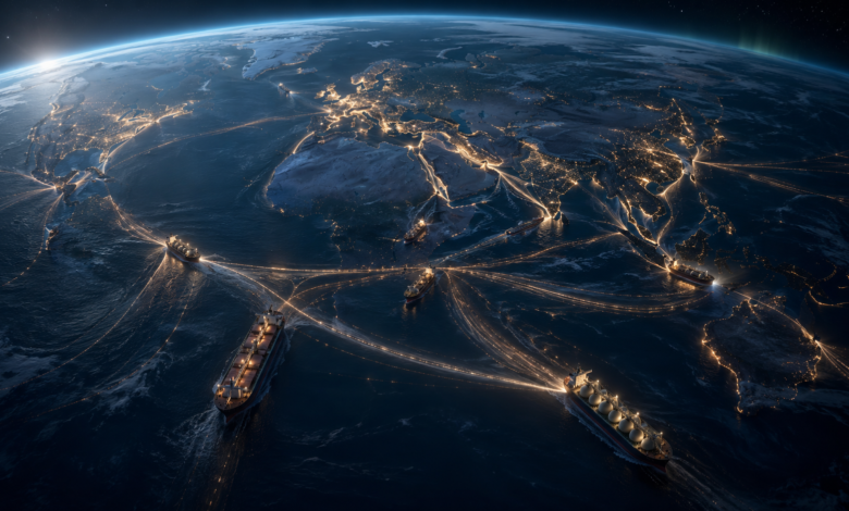
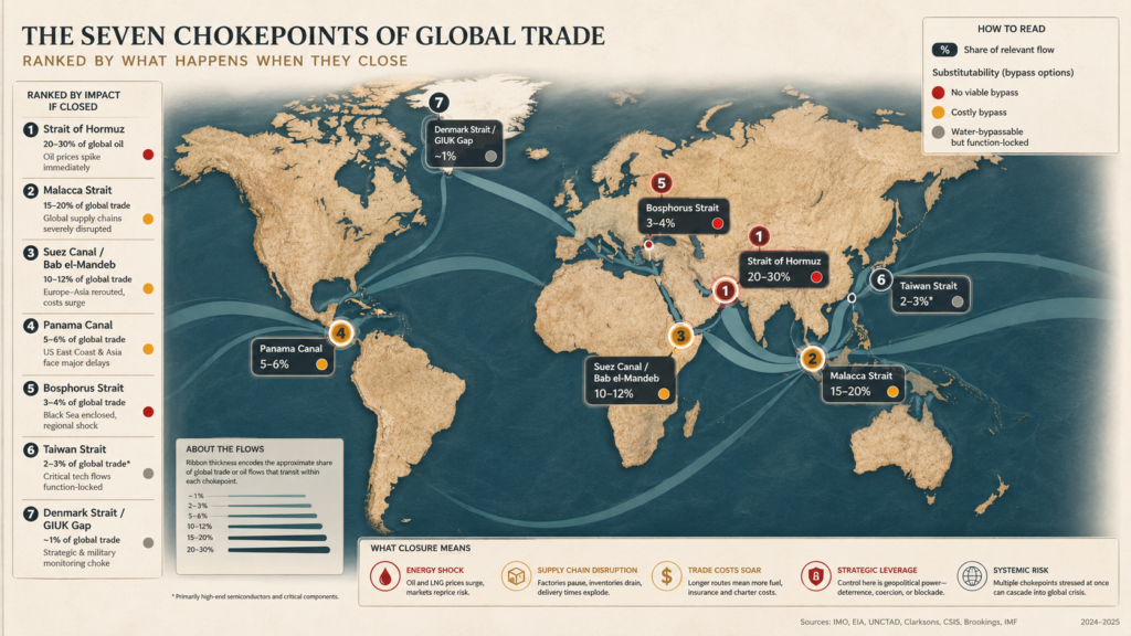
A quarter of the planet’s oil, nearly half its container fleet and almost all of its data are funnelled through a handful of narrow places. The stress tests of the 2020s revealed a hierarchy nobody had ranked — and taught us that a passage’s true power is measured only when it closes.
The fleet that could not move
From the deck of a supertanker idling off the coast of Oman in the spring of 2026, the sea looked ordinary — grey, patient, faintly oiled by the wind. The navigation screen told a different story. On it, the vessel appeared to be sailing several miles inland, gliding serenely across the mountains of the Musandam Peninsula. Other ships on the display circled in the desert, or drifted through the runway of an airport, or hovered above a nuclear reactor. None of it was real. The satellites had been lied to, and the lie had propagated downstream into every system that trusted them.
Behind that tanker, more than eight hundred others lay at anchor, engines cold, waiting for word that never came cleanly. The Strait of Hormuz — the twenty-one-mile gate through which roughly a fifth of the world’s oil normally passes — had been declared closed. Insurers withdrew cover overnight. War-risk premiums that had been a fraction of a percent of a hull’s value leapt several-fold, adding millions of dollars to a single crossing. Brent crude, quiet at seventy-one dollars in late February, was trading in the nineties by mid-March. In the wheelhouses, crews navigated by eye, the way their great-grandfathers had, because the twenty-first century’s most trusted instrument had become the least reliable thing aboard.
A narrow place had reached out and stopped a fifth of the world’s oil — and the world discovered it had nowhere else to send it.

It is tempting to read a scene like this as an aberration, a spasm of one bad year. It is closer to a revelation. The modern economy is often described as borderless, weightless, digital. It is nothing of the kind. It is a physical system that still moves more than four-fifths of its goods by sea, and that system does not spread its risk evenly across the oceans. It concentrates it, deliberately, on a few narrow points — and then optimises everything else around the assumption that those points will stay open.

This is an investigation into those points: what they carry, why they matter, and what the extraordinary run of crises between 2021 and 2026 taught us about which of them the world can survive losing, and which it cannot.
The hidden geography of everything
The map most of us carry in our heads is a map of countries — coloured shapes, capitals, borders. The map that actually governs prices in a supermarket in Casablanca or a factory in Ohio looks nothing like it. It is a map of water, and of a few dozen gaps in the land where that water squeezes between continents.
The reason is containerisation. When a standardised steel box first bolted a ship to a truck to a train in the late 1960s, it did more than cut the cost of moving cargo; it made the whole planet into a single production line. Components could be made wherever they were cheapest and assembled wherever it made sense, so long as the boxes kept flowing. Efficiency became the organising religion of global trade, and efficiency has a price: it strips out slack. A system with no spare capacity is fast and cheap, and it is also brittle. It has no margin for a closed door.
And the doors are few. A ship carrying trainers from Vietnam to Germany, or crude from Kuwait to South Korea, cannot take just any line across the globe. Geography funnels it. Between the Indian Ocean and the Pacific there is essentially one economical gate; between Europe and Asia, one canal; between the Atlantic and the Pacific through the Americas, one lock system fed, improbably, by rainforest rain. These are the chokepoints — places where a large share of a vital flow passes through a corridor narrow enough that a single accident, storm, blockade or drought can throttle it.
The true measure of a chokepoint is not how much it carries. It is what happens when it closes.
Here is where the conventional account goes wrong. Chokepoints are usually described as interchangeable “arteries,” each equally able to stop the heart. The events of the 2020s proved the opposite. They form a strict hierarchy, and the axis that ranks them is not traffic but substitutability — the presence or absence of a way around. When the Suez route became a war zone for the better part of two years, ships rerouted around Africa at real but bearable cost, and Europe–Asia trade, remarkably, held up. When Hormuz closed, there was no such exit for the oil behind it. The most photographed chokepoint on Earth turned out to be survivable. The one most people cannot picture turned out to be irreplaceable.
| How to read a chokepoint The four questions that rank a narrow place Volume: how large a share of a vital flow — oil, containers, grain, data — passes through it? This is the figure that makes headlines, and the least useful on its own. Substitutability: is there a physical alternative, and at what cost in distance, time and money? A chokepoint with a bypass is an inconvenience. One without a bypass is a hostage. Concentration: does the flow depend on something that exists in only one place — Gulf spare oil capacity, Taiwanese fabrication — so that rerouting the ship does not reroute the dependency? Governance: who controls passage, and by what rule — a navy, a treaty, the weather? The answer decides whether the risk is military, legal or climatic. |
Hormuz: the passage with no exit
Begin with the one that cannot be replaced. The Strait of Hormuz, pinched between Iran and the tip of Oman, connects the Persian Gulf to the open ocean. In an ordinary year around twenty million barrels of oil a day move through it — close to a fifth of global petroleum consumption and roughly a quarter of all seaborne oil, according to the U.S. Energy Information Administration and the International Energy Agency. It is also the exit for the overwhelming majority of Qatari and Emirati liquefied natural gas, some fifth of the world’s LNG trade.
What makes Hormuz singular is not the volume; Malacca carries more oil. It is the absence of an exit. The Gulf is a near-enclosed sea with one navigable mouth. The pipelines built precisely to bypass the strait — Saudi Arabia’s East–West line to the Red Sea, the Emirati line to Fujairah on the Gulf of Oman — can between them carry only a fraction of what the strait moves. Behind Hormuz sits something rarer still: almost all of the world’s spare oil production capacity, the cushion that markets draw on in a crisis. Close the strait and you do not merely stop twenty million barrels; you also lock away the reserve the world would use to compensate.
Behind Hormuz sits the world’s spare capacity — the very cushion a crisis would reach for, sealed behind the same closed door.
The theory became an experiment in 2026. Following military strikes on Iran in late February, Iranian forces declared the strait closed and began threatening and attacking vessels attempting to transit, according to the U.S. Congressional Research Service. Traffic collapsed by more than nine-tenths within days. Analysts at the Center for Strategic and International Studies described the waterway as effectively closed from early March; the International Energy Agency characterised the episode as one of the largest supply disruptions in the history of the oil market. Around twenty thousand mariners were left stranded inside the Gulf, the International Maritime Organization reported, and the tankers that dared the passage found the Emirati bypass terminus at Fujairah itself under threat.
A memorandum brokered in June 2026 reopened the strait under a sixty-day, toll-free window, and vessels began trickling back. But the recovery was thin and fragile: in the first eighteen days barely five hundred ships passed — a fraction of the roughly one hundred a day that crossed before the war, according to Al Jazeera’s reading of port-tracking data — and by mid-summer the truce was fraying again, with fresh attacks on shipping and the passage once more contested. The lesson was not that Hormuz is doomed to close. It is that when it does, the map offers no second answer.
Malacca: the funnel of Asia
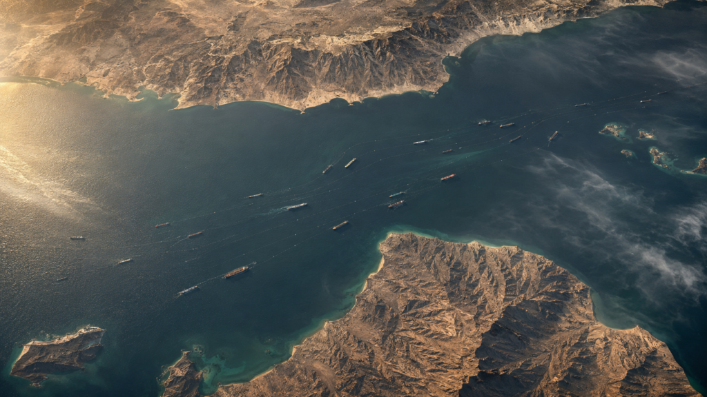
If Hormuz is the world’s oil valve, the Strait of Malacca is its main supply line to the factories of the East. The eight-hundred-kilometre channel between the Malay Peninsula and Sumatra is the shortest sea route between the Indian and Pacific Oceans, and by the EIA’s count it carries more oil than any other chokepoint on Earth — some twenty-three million barrels a day — along with a vast share of the manufactured goods flowing to and from China, Japan and South Korea.
At its southern end the passage narrows toward Singapore into the Phillips Channel, a corridor only a couple of kilometres wide at points — a bottleneck within a bottleneck. For centuries this was among the most piracy-prone waters in the world, and coordinated patrols by Indonesia, Malaysia and Singapore only tamed it in the last two decades. But Malacca’s deepest vulnerability is strategic rather than criminal, and it has a name coined in Beijing: the Malacca Dilemma. The great majority of China’s imported oil passes through a strait it does not control and could not easily keep open in a confrontation.
Unlike Hormuz, Malacca has alternatives — of a kind. Ships can divert south through the Sunda or Lombok Straits in Indonesia, adding perhaps a thousand nautical miles and several days to a voyage. That is a meaningful buffer, and it is precisely why Malacca sits a rung below Hormuz on the ladder of fragility: painful to lose, but not fatal. It is also why China has spent a fortune trying to route around the dilemma entirely — pipelines through Myanmar, rail corridors across Eurasia, ports strung along the Indian Ocean — an infrastructure of anxiety built by the country with the most to lose from a single narrow sea.
The Red Sea gates: Bab el-Mandeb and Suez
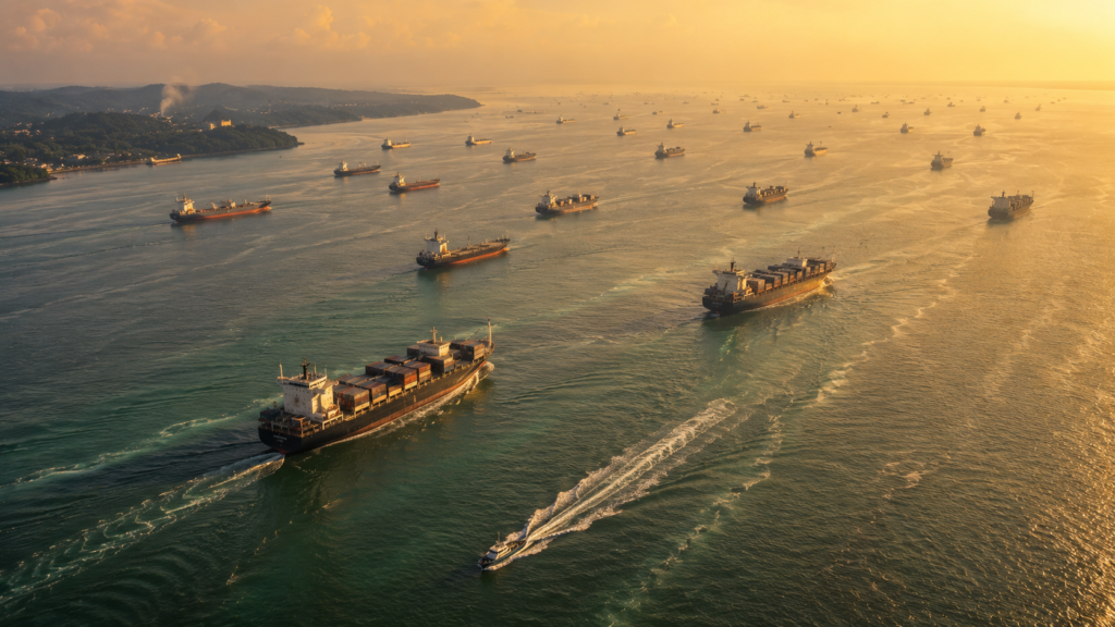
Two of the seven guard a single corridor. At its southern end the Bab el-Mandeb — the “Gate of Grief” — separates Yemen from the Horn of Africa; at its northern end the Suez Canal cuts through Egypt to the Mediterranean. Between them runs the Red Sea, the shortest maritime bridge between Europe and Asia. Together they normally handle somewhere between a tenth and a seventh of world maritime trade and close to a third of global container traffic.
They are also the chokepoint that the 2020s proved the world can, at a price, do without. When the container ship Ever Given wedged itself across the Suez Canal in March 2021, it blocked the passage for six days and held up an estimated nine billion dollars of trade a day — a spectacular illustration of concentration. Yet that was a brief mechanical accident. The deeper test came from Yemen.
From November 2023, Houthi forces began attacking commercial vessels in the Red Sea in connection with the war in Gaza. Container traffic through Suez fell by three-quarters and more; daily transits through Bab el-Mandeb dropped from around seventy to under twenty. The major lines — Maersk, MSC, CMA CGM, Hapag-Lloyd — did the one thing Hormuz never permits: they went around. The detour past the Cape of Good Hope adds roughly three and a half to four thousand nautical miles and ten to fourteen days to an Asia–Europe voyage, and about a million dollars in cost, and it swallowed perhaps a fifth of the world’s effective shipping capacity. For Egypt it was a fiscal wound — Suez Canal revenue in the last quarter of 2024 fell to under nine hundred million dollars from two and a half billion a year earlier, and the state lost well over eight billion in all.
Suez was closed in all but name for two years — and Europe and Asia went on trading. That is what a survivable chokepoint looks like.
And yet global commerce absorbed it. The route was longer, dirtier, dearer; ships were added to keep schedules; freight rates spiked. But the goods still moved. Even after ceasefires in mid- and late 2025 quieted the attacks, carriers were slow to return — by early 2026 Suez traffic remained around sixty percent below its old level — because the industry had already priced in the detour. A chokepoint that can be bypassed for two years without breaking the world economy is, by definition, not the one that holds it. It is the presence of the Cape, an ocean away, that demotes Suez from irreplaceable to merely expensive.
Panama: the chokepoint throttled by fresh water
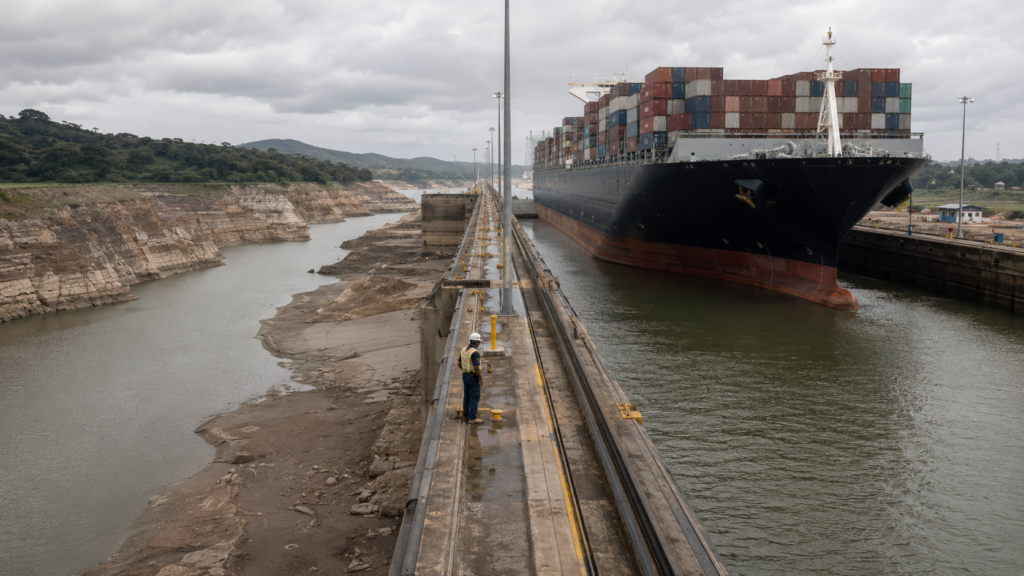
The most quietly astonishing vulnerability belongs to Panama, and it is not military at all. The canal that joins the Atlantic and the Pacific does not run on seawater. Its locks are filled and flushed by fresh water tumbling down from Gatún Lake, an artificial reservoir fed by rainforest rainfall — the same lake that supplies drinking water to Panama City and Colón. Each ship that crosses drains millions of gallons toward the sea. When the rain fails, the world’s busiest inter-oceanic shortcut runs dry.
In 2023 and 2024 it did. A drought driven by El Niño and, researchers increasingly argue, by a warming climate pushed Gatún Lake to its lowest January level on record. The Panama Canal Authority was forced to cut daily transits from the usual thirty-six to thirty-eight down to as few as twenty-two, and to reduce the permitted draught so that container ships rode higher and carried less. Queues lengthened; slot auctions soared; carriers rerouted. Liquefied-gas traffic, exquisitely sensitive to draught limits, fell by as much as three-quarters. It was, in effect, an ocean passage strangled by a shortage of the wrong kind of water.
Heavier rains and a shift to La Niña restored near-normal operations through 2025. But the reprieve is conditional. A 2025 study in Geophysical Research Letters projected that under higher-emissions pathways, minimum lake levels decline substantially across the century, making the transit restrictions of the recent drought progressively more common. The canal’s answer — a new reservoir on the Río Indio, a pipeline “land bridge” for gas — will not be ready before the next El Niño is expected around 2027. Here the governing power is neither a navy nor a treaty but the sky.
The drought exposed a second layer of fragility: control. Because roughly forty percent of all United States container traffic passes through Panama, the ports at either end of the canal became a geopolitical prize. In early 2025 the American administration pressed to reduce Chinese influence over the two flanking terminals, then operated by Hong Kong’s CK Hutchison; a Western consortium led by BlackRock announced a roughly twenty-three-billion-dollar deal to buy the wider Hutchison ports business, Beijing moved to stall it through antitrust review and to insert its own state shipping champion, and in February 2026 Panama’s Supreme Court voided the concessions and handed interim control to Maersk and MSC. A waterway can be throttled by drought one year and contested by great powers the next.
The Bosphorus: a treaty as a chokepoint
Some chokepoints are made of water and rock. One is made largely of law. The Bosphorus and the Dardanelles — the Turkish Straits — are the only way in or out of the Black Sea, and at the Bosphorus the passage narrows to just seven hundred metres as it threads through the heart of Istanbul, five great oil tankers a day sliding past apartment windows. Roughly three million barrels of Russian and Caspian crude, about three percent of global supply, transit here daily, alongside close to a fifth of the world’s wheat exports.
What governs this passage is a document signed in 1936: the Montreux Convention, which grants Turkey sovereignty over the straits while guaranteeing merchant vessels free passage in peacetime and giving Ankara the right to restrict warships in war. For nearly ninety years it has held through world wars and cold wars alike. When Russia invaded Ukraine in 2022, Turkey invoked the convention to bar belligerent warships, and the straits became a strategic instrument wielded not by force but by treaty — a chokepoint closed with a legal clause.
The Black Sea grain that flows through the Bosphorus feeds much of the Middle East and North Africa, which is why the interruption of Ukrainian exports after 2022 registered as a food-security shock far from the front line. It is also why the corridor is a live theatre of the war: Ukrainian drones drove Russia’s Black Sea Fleet from Crimea to the eastern shore without a NATO vessel firing a shot — chokepoint geography shaping a modern conflict. Turkey’s long-mooted Istanbul Canal, which would run west of the Bosphorus and let Ankara charge tolls and sidestep Montreux, remains suspended; for now the treaty, not the trench, keeps the gate.
Taiwan: where the chokepoint left the water
The last of the seven is the one that rewrites the definition. By ship volume the Taiwan Strait is the largest chokepoint of all: about forty-four percent of the world’s container fleet and the great majority of its largest vessels passed through it in 2022, carrying an estimated two and a half trillion dollars of goods — more than a fifth of all maritime trade by value, by the reckoning of the Center for Strategic and International Studies. Japan and South Korea depend on it for a substantial share of their entire trade; more than half of the voyages through it are simply Chinese ships moving between Chinese ports.
Yet the strait’s water is, in a strategic sense, the least of it. Ships can round the island’s Pacific coast, adding only a day or so — a bypass Hormuz can only dream of. What cannot be bypassed sits on the land. Taiwan manufactures more than ninety percent of the world’s most advanced logic chips; a single company, TSMC, dominates leading-edge production so completely that alternative capacity in Arizona, Japan and Europe still amounts to less than a tenth of it and cannot substitute before the end of the decade. Most electronics makers hold three to four months of chip inventory. After that, in a serious blockade, the assembly lines of the modern world begin to fall silent.
Ships can sail around Taiwan in a day. The world cannot sail around its foundries in a decade.
This is the renversement that reorganises the whole subject. The classic chokepoint is a place where you cannot move a ship. The twenty-first-century chokepoint is a place where you cannot move a dependency — where an irreplaceable function has been concentrated in a single vulnerable spot, whether or not there is a way around by sea. Through 2025 and 2026 the pressure grew unmistakable: Chinese naval and coast-guard forces rehearsed the tools of a blockade, Beijing’s exercises edged closer to encirclement, and by mid-2026 Britain, France and Germany were issuing joint statements defending freedom of navigation in the strait. The contest is no longer really about a channel of water. It is about who controls the machines that make the century’s most important commodity.
The invisible chokepoints
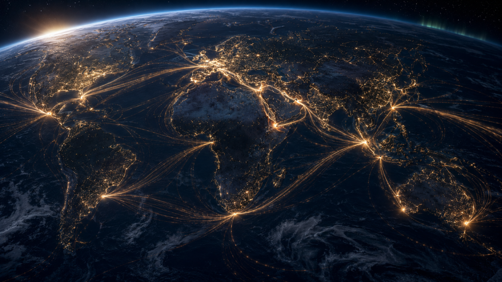
There is a second map layered over the first, and it is drawn in glass. Roughly ninety-nine percent of the world’s intercontinental data — the traffic of markets, banks, clouds and governments — travels not by satellite but through some six hundred fibre-optic cables laid across the ocean floor. And those cables funnel through the same narrow seas as the ships. The Red Sea alone carries an estimated seventeen percent of global internet traffic, its cables crowded within kilometres of one another at the Bab el-Mandeb pinch.
In February 2024 that concentration bit. A bulk carrier struck by a Houthi missile, the Rubymar, drifted with its anchor down and severed several major cables, disrupting a large share of internet traffic between Asia, Europe and the Middle East; further Red Sea cuts followed in 2025. In the Baltic, cables between Finland and Germany and between Lithuania and Sweden were cut within hours of each other in late 2024, with suspicion falling on the dragging anchors of passing vessels; around Taiwan, similar incidents multiplied. Investigators counted a cluster of Baltic and Taiwanese cable failures across 2024 and 2025, several involving ships with opaque ownership. The internet, built for redundancy, rerouted around the damage and stayed up — resilience and fragility revealed in the same event.
Then there is the sky. The satellite signals that guide ships and aircraft — the Global Positioning System and its cousins — have become a battlefield of their own. Jamming drowns them; spoofing feeds them convincing lies. Aviation interference incidents rose several-fold in 2024; by mid-2025 more than ten thousand vessels in a single quarter were reporting disruption. During the 2026 Gulf crisis, thousands of ships in and around Hormuz saw their positions scattered across deserts and airports, a container vessel ran aground off Jeddah after its navigation was corrupted, and crews fell back on radar and eyesight. The instruments the modern world trusts most, it turns out, are among the easiest to deceive.
| The stack of dependencies Why the same narrow seas keep appearing The Red Sea is not one chokepoint but three stacked on top of each other: a shipping lane, a data corridor and, at Bab el-Mandeb, an energy gate. A single anchor can threaten all three. Data reroutes in milliseconds; oil cannot reroute at all if there is no pipe; a chip cannot be made anywhere else for years. The three layers fail on completely different timescales — which is exactly what makes a combined shock so hard to plan for. Redundancy is the whole game. The internet survived its cable cuts because it had spare paths. Hormuz has no spare path. The difference between an inconvenience and a catastrophe is the number of alternatives. |
The moving map
The most unsettling discovery of the decade is that the map of chokepoints is not fixed. Climate is redrawing it in real time — closing some passages and prising others open. The Panama drought is one edge of that shift; the other is the Arctic, where retreating sea ice is slowly making a Northern Sea Route along Russia’s coast navigable for part of the year, a corridor that could one day shave thousands of miles off the Asia–Europe run and quietly diminish the relevance of Suez and the Bosphorus for some cargoes. A warming planet does not merely stress the old gates; it engineers new ones.
Technology pulls in the same direction. Autonomous and remotely operated vessels are moving from trial to service, and navies and shipping lines alike are wiring artificial intelligence into routing, port logistics and threat detection. That promises efficiency — and a new attack surface, since a fleet that steers by software can be misdirected by software. The same is true of the satellite backbone and the cable network: every layer of automation that removes a human from the loop also removes a fallback when the automation is fooled.
Which brings the argument back to money, and to the one number readers actually feel: prices. When the Red Sea closed, freight rates on the Asia–Europe run rose roughly fivefold at the peak, and the effect on inflation became a subject of genuine scholarly dispute. J.P. Morgan estimated the disruption could add around seven-tenths of a percentage point to global core goods inflation in the first half of 2024; the OECD warned that a sustained doubling of freight rates could lift consumer-price inflation by several tenths of a point after a year; economists writing for the Centre for Economic Policy Research found the actual effect muted — because the system had slack, inventories were full and there was a way around.
The shock was mild when there was slack and a bypass. It is the chokepoints with neither that turn a disruption into an emergency.
That caveat is the whole thesis in miniature. The Red Sea shock was absorbable because the world had spare ships and the Cape of Good Hope. The 2026 Hormuz shock was different in kind: it struck energy, where the spare capacity itself sits behind the closed door, and it offered no bypass, and so it fed straight into the price of oil and, through it, into everything. When container rates doubled again in the spring of 2026, it was not the Red Sea talking. It was Hormuz.
The arithmetic of fragility
For half a century the world pursued a single, seductive bargain: trade resilience for cost. It concentrated production where it was cheapest, thinned out its inventories, and routed the results through the fewest, shortest passages it could find. The bargain worked spectacularly. It gave a factory worker in one hemisphere access to the labour of another, and it filled shelves with goods at prices that would have seemed impossible to an earlier age. What it also did, quietly, was stack the most irreplaceable functions of modern civilisation onto a handful of the least substitutable points on the planet — the Gulf’s oil behind one strait, the world’s advanced silicon on one island, a fifth of its data through one crowded sea.
The 2020s ran the stress test that the design had always implied. A ship wedged in Suez; a rainforest reservoir run dry; anchors on the seabed of the Baltic; a lie whispered to a satellite over Hormuz. None of these was, in itself, the end of anything. Together they delivered a single, clarifying lesson: the modern economy is not held up by its vast oceans but by the narrow gaps between them, and those gaps are not equal. Some can be lost and merely mourned. A few cannot be lost at all.
The comfort, such as it is, lies in the fact that we now know which are which. The danger lies in how little we have done about it. To depend on a place is not, by itself, folly; every civilisation has depended on its rivers and its roads. The folly is to depend on it without a way around, and to notice only when the door swings shut. The next time a screen shows a supertanker sailing serenely across a mountain range, it will be worth remembering that the mountain was real, the ship was real, and only the map was lying — and that the map, in the end, is the thing we built the whole world to trust.
The seven at a glance
A comparative reading of the world’s primary maritime chokepoints, ranked by the question that matters most — whether there is a way around.
| Chokepoint | What it moves | Headline share | Main bypass | Substitutability |
| Strait of Hormuz | Crude, products, LNG | ~20 mb/d oil; ~a quarter of seaborne oil | Limited pipelines only | Very low — no exit |
| Strait of Malacca | Oil + manufactured goods | ~23 mb/d oil; busiest oil chokepoint | Sunda / Lombok (+days) | Low–moderate |
| Suez Canal | Containers, oil, grain | ~30% of container trade | Cape of Good Hope | Moderate — costly bypass |
| Bab el-Mandeb | Gateway to Suez / Red Sea | ~10% of seaborne oil | Cape of Good Hope | Moderate — costly bypass |
| Panama Canal | Containers, LNG, dry bulk | ~40% of US container traffic | Cape Horn / Suez / land | Moderate — plus drought risk |
| Bosphorus & Dardanelles | Russian/Caspian oil, grain | ~3% of oil; ~a fifth of wheat | None (sole Black Sea exit) | Very low — sole exit |
| Taiwan Strait | Containers; adjacent to chips | ~44% of container fleet (2022) | East of Taiwan (+~1 day) | Water yes; foundries no |
Figures are indicative annual averages drawn from EIA, IEA, CSIS, UNCTAD and Congressional Research Service material; see the fact-check ledger for confidence ratings. mb/d = million barrels per day.
Oil through the gates
Crude oil and petroleum liquids by chokepoint, first half of 2025, in million barrels per day — the clearest single measure of the world’s energy exposure.
| Passage | Oil (mb/d, 1H 2025) | Reading |
| Strait of Malacca | 23.2 | Largest oil chokepoint |
| Strait of Hormuz | 20.9 | Least substitutable |
| Cape of Good Hope | 9.1 | The bypass, not a chokepoint |
| Suez Canal + SUMED | 4.9 | Depressed by Red Sea crisis |
| Bab el-Mandeb | 4.2 | Depressed by Red Sea crisis |
| Turkish Straits | 3.7 | Russian & Caspian crude |
| Panama Canal | 2.3 | Recovered from drought |
Source: U.S. Energy Information Administration, World Oil Transit Chokepoints (data to first half 2025). The Cape of Good Hope is a route, not a chokepoint; its rising volume is a direct measure of diversion away from the Red Sea.
The cost of going around
| Chokepoint | If it closes, ships… | Penalty |
| Hormuz | have essentially nowhere to go by sea | Oil price shock; spare capacity trapped |
| Malacca | divert via Sunda or Lombok | ~+1,000 nm; several days |
| Suez / Bab el-Mandeb | sail around the Cape of Good Hope | ~+3,500–4,000 nm; +10–14 days; ~$1m/voyage |
| Panama | use Cape Horn, Suez, or US land bridge | Weeks; higher cost per container |
| Bosphorus | cannot leave the Black Sea at all | Total closure of exports |
| Taiwan Strait | round Taiwan’s east coast | ~+1 day by sea; chips irreplaceable for years |
Distances and times are representative estimates from OECD/ITF, CRS and industry analyses.
A timeline of the world’s narrow places
1869 · The Suez Canal opens, cutting weeks off the Europe–Asia voyage and inventing the modern chokepoint.
1914 · The Panama Canal opens, joining the Atlantic and Pacific — and binding global trade to a rainforest reservoir.
1936 · The Montreux Convention gives Turkey control of the Bosphorus and Dardanelles, a chokepoint governed by treaty.
1967–75 · The Suez Canal is closed for eight years by Arab–Israeli conflict, the longest modern chokepoint shutdown.
1980–88 · The Iran–Iraq “Tanker War” turns Hormuz into a battleground; the U.S. Navy escorts Gulf shipping.
2008–11 · Somali piracy peaks in the Gulf of Aden, prompting international naval patrols off Bab el-Mandeb.
Mar 2021 · The Ever Given wedges across Suez for six days, holding up an estimated $9bn of trade a day.
Feb 2022 · Russia invades Ukraine; Turkey invokes Montreux; Black Sea grain exports become a global flashpoint.
Late 2023 · Drought forces the Panama Canal to slash daily transits and cut permitted draught.
Nov 2023 · Houthi attacks begin in the Red Sea; carriers start rerouting around the Cape of Good Hope.
Feb 2024 · The drifting Rubymar severs Red Sea data cables, revealing the internet’s undersea chokepoints.
Nov 2024 · Baltic Sea cables are cut within hours of each other amid suspicion of deliberate anchor-dragging.
Mar 2025 · A BlackRock-led consortium agrees to buy CK Hutchison’s ports business, igniting a fight over Panama’s terminals.
2025 · Ceasefires quiet the Red Sea, but Suez traffic stays far below normal as carriers keep to the Cape.
Feb–Mar 2026 · Conflict with Iran effectively closes the Strait of Hormuz; oil prices surge; ~20,000 mariners are stranded.
Jun 2026 · A brokered memorandum partially reopens Hormuz under a toll-free window, but traffic stays thin and the truce fragile.
Key takeaways
- Traffic is the wrong yardstick. A chokepoint’s real power is measured by what happens when it closes — that is, by whether a bypass exists.
- Hormuz is the one that cannot be replaced. Roughly a fifth of the world’s oil, no viable sea alternative, and the world’s spare capacity trapped behind the same door.
- Suez proved survivable. Two years of effective closure were absorbed because ships could round the Cape of Good Hope — expensive, but possible.
- Panama runs on rain. An ocean passage throttled by a shortage of fresh water is a preview of climate risk to hard infrastructure.
- The Bosphorus is closed with a clause. The Montreux Convention shows a chokepoint can be governed by treaty as much as by geography.
- Taiwan redefines the term. Ships can round the island; the world cannot round its foundries, where over 90% of advanced chips are made.
- There is a second, invisible map. Around 99% of intercontinental data runs through undersea cables funnelling through the same narrow seas.
- Satellites can be made to lie. GPS jamming and spoofing have turned the world’s most trusted navigation tool into a live vulnerability.
- The map is moving. Climate is closing Panama in dry years and prising open the Arctic — chokepoints are being created and destroyed.
- Inflation impact depends on slack. The Red Sea shock was mild because the system had spare capacity; an energy chokepoint with no bypass is another matter.
- Redundancy is everything. The difference between an inconvenience and a catastrophe is simply the number of alternatives.
- Efficiency was bought with fragility. Half a century of optimisation concentrated irreplaceable functions on a handful of vulnerable points.
Did you know?
- The Bosphorus narrows to about 700 metres as it runs through the middle of Istanbul — roughly five large oil tankers a day pass within sight of the city’s apartment windows.
- The Panama Canal’s locks are filled with fresh water; every transit drains millions of gallons from a lake that also supplies drinking water to two cities.
- About 44% of the world’s container fleet passed through the Taiwan Strait in 2022 — yet ships can avoid it entirely by rounding the island’s Pacific coast.
- Detouring around the Cape of Good Hope instead of using Suez adds roughly 3,500–4,000 nautical miles and up to two weeks to an Asia–Europe voyage.
- Roughly 99% of the world’s intercontinental internet traffic travels through undersea cables, not satellites.
- In April 2024, GPS spoofing over the Eastern Mediterranean made 117 ships appear, simultaneously, to be sitting at Beirut airport.
- The Strait of Malacca’s Phillips Channel narrows to only a couple of kilometres — a bottleneck inside one of the world’s busiest sea lanes.
- During the 2026 Gulf crisis, navigation screens showed supertankers apparently sailing across mountains, airports and a nuclear plant as satellite signals were faked.
- The Ever Given blocked the Suez Canal for six days in 2021, holding up an estimated nine billion dollars of trade every single day.
- The Turkish Straits carry close to a fifth of the world’s wheat exports — which is why a war on the Black Sea becomes a food crisis in North Africa.
- Behind the Strait of Hormuz sits almost all of the world’s spare oil production capacity — the very cushion markets would reach for in a crisis.
- Many ships still navigate on GPS receivers whose technology is around fifteen years out of date, leaving them unusually easy to deceive.
Fact-check ledger
Confidence reflects the strength and agreement of primary sources. Fast-moving 2026 events are flagged as fluid; where estimates diverge, the range and its cause are noted in the article.
| Statement | Confidence | Primary sources |
| ~20 mb/d of oil transits Hormuz; ~a quarter of seaborne oil trade. | HIGH | EIA World Oil Transit Chokepoints; IEA |
| Malacca is the busiest oil chokepoint (~23 mb/d, 1H 2025). | HIGH | EIA (Vortexa-based) |
| Suez handles ~30% of global container trade; Red Sea corridor ~12–15% of maritime trade. | HIGH | J.P. Morgan Research; UNCTAD |
| Cape reroute adds ~3,500–4,000 nm and 10–14 days. | HIGH | OECD/ITF; CRS; Atlas Institute |
| Suez container traffic fell ~75–90% after Nov 2023; revenue collapsed (~$8bn+ lost). | HIGH | World Bank/IMF PortWatch; Lloyd’s List; Egypt central bank |
| Panama runs on Gatún Lake fresh water; 2023–24 drought cut transits to ~22–24/day. | HIGH | Panama Canal Authority; BTS; Woodwell Climate |
| Higher-emissions climate pathways lower Gatún minimum levels this century. | HIGH | Muñoz (2025), Geophysical Research Letters |
| ~40% of US container traffic uses the Panama Canal. | HIGH | CNBC; industry consensus |
| Turkish Straits: ~3 mb/d oil (~3% supply); ~a fifth of world wheat; Montreux (1936). | HIGH | EIA; Carnegie; War on the Rocks |
| Taiwan Strait: ~44% of container fleet (2022); Taiwan >90% of advanced chips. | HIGH | USNI/Bloomberg; CSIS; ITA |
| ~$2.45tn of goods (>1/5 of maritime trade) transited the Taiwan Strait in 2022. | HIGH | CSIS ChinaPower, Crossroads of Commerce |
| ~99% of intercontinental data runs through undersea cables. | HIGH | Recorded Future; multiple |
| Feb 2024 Rubymar incident severed several Red Sea cables. | HIGH | Light Reading; GeoCables; industry reports |
| Share of data traffic disrupted by the 2024 Red Sea cable cuts. | MEDIUM | Estimates range ~25%–70% across sources |
| GPS jamming/spoofing surged 2024–26; 10,000+ vessels affected in a Q2 2025 quarter. | MEDIUM | Windward; GPSPATRON; Scientific American; CNN |
| Red Sea shock added ~0.3–0.7pp to inflation measures (H1 2024). | MEDIUM | J.P. Morgan; OECD — disputed by CEPR (muted) |
| 2026: strikes on Iran effectively closed Hormuz; traffic collapsed >90%; ~20,000 mariners stranded. | MEDIUM | CRS; CSIS; IMO; Al Jazeera |
| Exact day-to-day status/price levels of Hormuz through mid-2026. | LOW | Fluid; fast-moving, source figures vary daily |
| Specific leadership-casualty claims from the 2026 conflict. | LOW | Single-source / unverified — deliberately excluded |